Big Creek-Bouie River Watershed Improvements
Flood Mitigation and Resilience Improvements
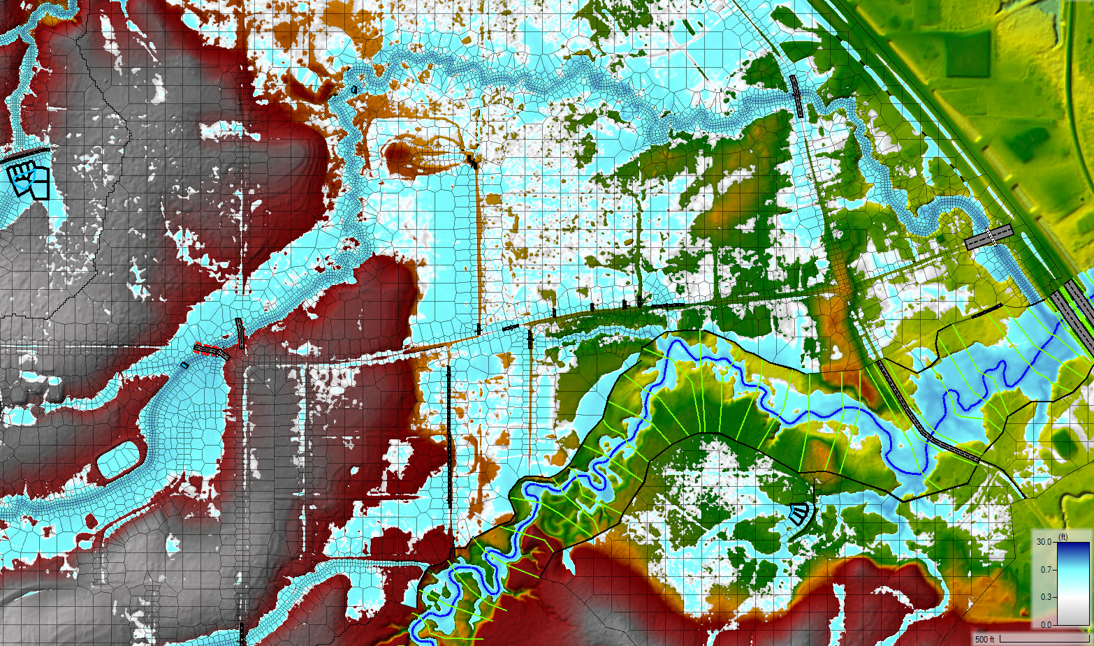
Rawl Springs, Mississippi, faces repetitive flooding, significantly impacting this economically depressed community. The area is at the downstream end of a small creek, draining approximately 32-square miles of primarily old agricultural land, which lies outside its jurisdictional limits and within the floodplain of the Leaf and Bouie Rivers. This project aims to address the urgent flood mitigation needs of the Rawl Springs community, enhancing safety and resilience against future flooding events.
Client
Mississippi Soil & Water Conservation Commission
Project Location
Rawl Springs, Mississippi

Flood Source Analysis
Digital Engineering (DE), as part of the Cypress-DE Joint Venture (JV), conducted a comprehensive hydrology and hydraulic study of the Big Creek and Mineral Creek watersheds to identify potential flood sources. Utilizing globally available data and in the absence of local stream data, the team developed an HEC-HMS model to predict peak discharges and establish base flows, storm response, and recession constants. The project is focused on evaluating multiple alternatives to mitigate both global and local flooding sources, addressing the unique challenges of lacking drainage system information and maintained drainage easements in Rawl Springs and Forrest County.
Flood Mitigation
The project is currently underway, with efforts concentrated on providing a full environmental assessment for two flood mitigation alternatives. The outcomes of this project will play a crucial role in developing effective flood mitigation strategies for the Rawl Springs community, with the potential to significantly improve their quality of life and environmental resilience.


